
How to use PondMAC
PondMAC gives a preliminary detention pond storage estimate for watersheds under 160 acres using the modified rational method. It should be used to quickly and conceptually determine the land requirements for stormwater detention.
1Design rainfall
In Map · Atlas 14 mode, search a place like "Austin" or a lat,lng pair in the search box, or click a point in Texas to pull live NOAA Atlas 14 (Vol. 11) point intensities. Pick the return period, or switch to Manual entry to type the seven duration intensities directly.
2Existing conditions
Enter the runoff coefficient C, time of concentration Tc, and area A for the existing (pre-development) basin. The maximum allowable release Q(allow) is computed automatically from these values. If you need to override the Q(allow), delete one of the three input values C, Tc or Area. This will change the Q(allow) to yellow, allowing for manual override.
3Proposed conditions
Enter C, Tc, and A for the developed basin draining to the pond. Areas at or above 160 acres are outside the method. Basins over 90 acres are allowed but better handled by full hydrograph routing.
4Read the results
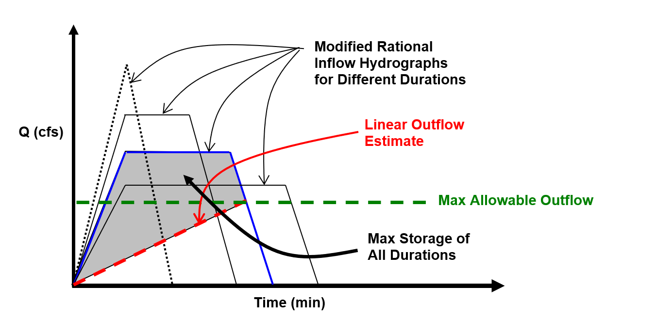
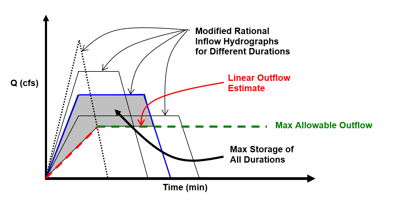
- This routine uses both the Triangular and Trapezoidal methods. Each method uses a different assumption for outflow.
- For both methods, inflow hydrographs are determined for multiple durations ranging from 1 to 180 minutes. The peak (maximum) volume from these methods and corresponding critical duration (Td) are determined. The Triangular and Trapezoidal cards show the required storage in acre-ft (and ft³) plus the critical storm duration that governs it.
5Recommended detention & footprint
Experience through final design "level pool routed" projects has shown that, assuming that you are required to detain for all events from the 2-year to 100-year, it is best to estimate detention volumes by summing the average storage values from both the 2-year and 100-year events. The summary tile (map mode) averages the triangular and trapezoidal storage for the 100-yr and 2-yr storms, then sums those two averages into a single recommended preliminary detention volume. An average depth of 5 feet is set as a default but can be adjusted if your site has more or less topographic relief. Drag the average depth slider to size a square footprint. Its length & width, plan area, and the site acreage to reserve for detention are the provided results.